
Walk a Seymour Street
A reliable Seymour street directory search begins with the mapped parcel, not a name copied from an old list. Jackson County’s tax tools accept a property address, parcel number, or owner name. The GIS adds parcel shape, situs address, owner mailing address, legal description, classification, and transfer leads. Once one parcel is open, map panning and parcel selection let you move along the same block. Save the date because these are current-facing systems.
Use this order to keep ownership, place, and occupancy evidence distinct:
- Enter the street address in the Jackson County auditor property search. Copy the parcel number, district, owner name, property address, and tax year.
- Open the same address in the Jackson County GIS viewer. Check the parcel outline, Card, Zoom view, situs address, mailing address, and legal lot or block.
- Pan along the street and inspect parcels one at a time. If the viewer returns a list, export it and record the export date.
- Take the owner, transfer date, document number, and legal description to the recorder index. Confirm the recorded instrument instead of treating a tax-card transfer row as a deed.
- For an older occupant question, compare the address with Seymour directories, maps, census releases, newspapers, and probate records.
The result is a street-by-street worksheet with sources attached, not a claim that every owner sleeps at the parcel or that every person at the address appears in public records.
Seymour Street Search Fields
The county tax screen is the fastest address-keyed entry point. Its own help warns that too much information can exclude a match. Try the street address first, then shorten it or search by last name if a parcel was split or combined recently. The following controls were documented in the live Jackson County system.
| Field | Use | Search note |
|---|---|---|
| Property or parcel number | Exact parcel or old map identity | Best bridge among GIS, tax, assessor, and recorder work |
| Name | Assessed owner | Try the last name and spelling variants |
| Property address | Situs street search | Begin with house number and street; remove excess terms if needed |
| City and state | Narrows place | Use Seymour and Indiana where accepted |
| Tax year | Chooses available roll year | The complete option list was not exposed in research |
| District and parcel | Result identifiers | Keep both when adjoining parcels cross a taxing district |
The GIS owner form separately requires a last name and permits a first name. Its Sales tab can filter minimum and maximum sale date, price, acreage, neighborhood, and property class. General map search can use an address or parcel. Neither portal publishes a firm first year of online coverage.
Seymour Records Along Each Street
No single Seymour street directory answers every address question. The parcel number and legal description connect several independent layers, while the modern street name connects maps, permits, and directory material. Each layer also has its own access path and limit.
| Address layer | What it can establish | Access | Limit |
|---|---|---|---|
| GIS parcel map | Parcel, owner, situs, mailing, legal lot, card, and transfer leads | Free online map, Card, Zoom, and export | Not a legal survey |
| Tax and assessment roll | Owner, district, assessed value, charges, and tax year | Auditor, treasurer, assessor portal, or counter | Owner does not prove occupant |
| Recorded instruments | Grantor, grantee, deed, mortgage, lien, release, and legal description | Fidlar, recorder counter, written copy request, or microfilm | Online cutoff is unpublished |
| Planning records | Permit, inspection, plat, E911 address, rezone, or code action | Address-specific APRA request | No public permit index found |
| Voter records | Registration or polling information allowed by law | IndianaVoters, Clerk counter, or VRG-24 route | Not a complete street roster |
| Directories and maps | Historical occupant clue, footprint, lot, or old road | Seymour Library, State Library, NPS, and Surveyor | Issue and coverage vary |
The table also shows why a missing online hit is not the end. A counter index, written request, microfilm reel, or library shelf can continue a search when a web portal has no early data.
Read a Seymour Parcel Card
The researched card for 100 St Louis Avenue shows how much can sit behind one street number. It identifies parcel 36-66-17-317-045.001-009, owner 100 SLA, LLC, a PO Box 101 mailing address, district 009 Seymour Community, and a legal description covering Lots 7, 8, 9 and part of Lot 6 in Block K. The situs and mailing locations are plainly different.
The Jackson GIS owner and sales search is shown below as the source interface for this street-directory step.
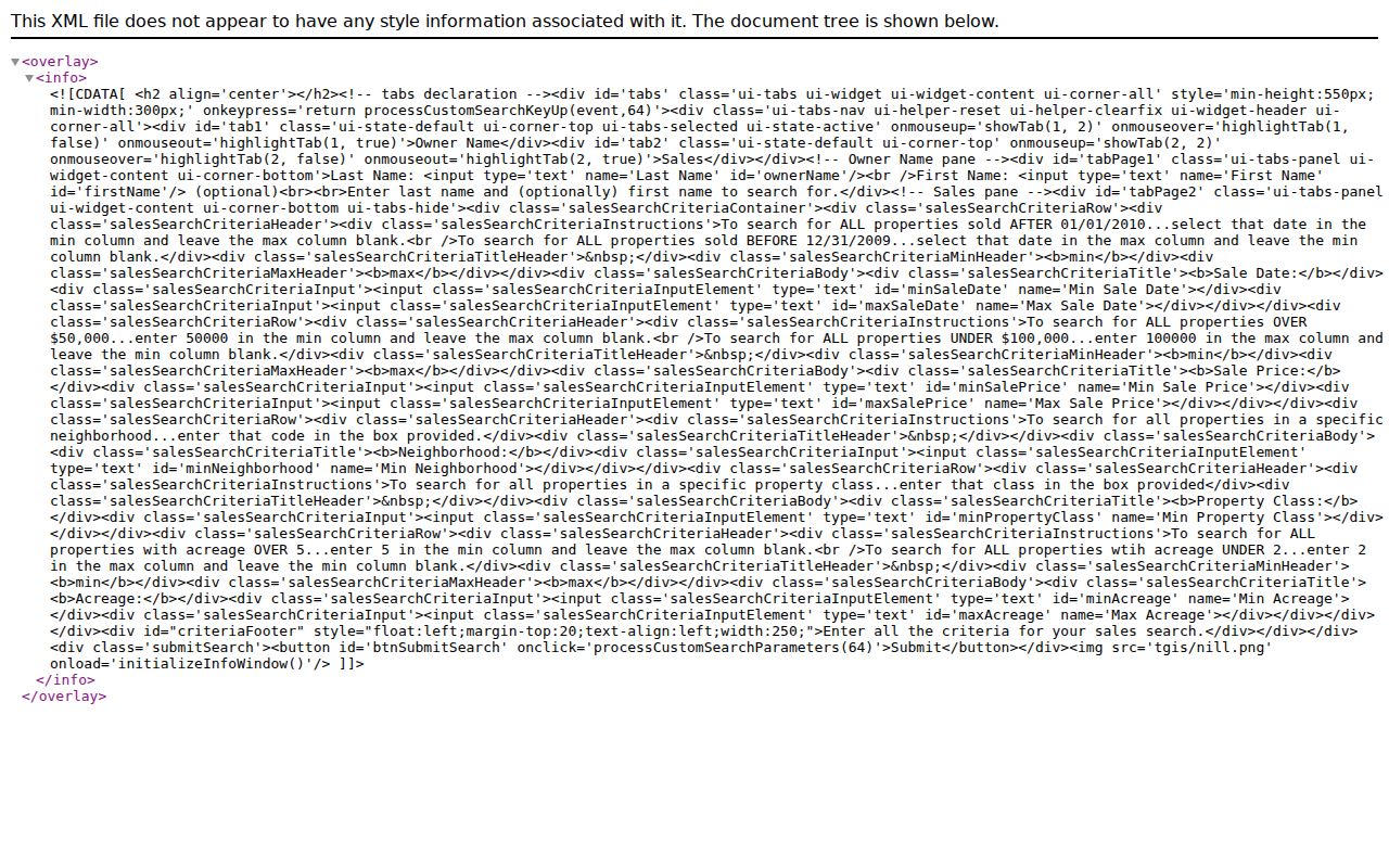
The viewer is where an address becomes a parcel and a transfer lead. Its Card result must still be checked against the recorder’s document.
Transfer rows on the sample run from 2000 through 2019 and include document IDs, book and page references, values, and nonuniform codes. A “Comp” line warns against calling every entry a normal sale. Document 201906368 is a recorder lead, not the deed image itself. Valuation figures may also be work in progress and not yet certified.
- Parcel
- A county assessment unit with its own identifier; it may contain land, a structure, or both.
- Situs address
- The physical location assigned to the parcel, distinct from the address used to mail the owner’s tax correspondence.
- Plat
- A recorded drawing that lays out lots, blocks, streets, or a subdivision.
- Criss-cross directory
- A directory section arranged by address rather than only by a person’s surname.
Follow Seymour Deeds by Street
A deed search does not begin with the street field. Jackson County Recorder’s FAQ says staff cannot locate a deed from a parcel number or street address alone. Bring the owner name and an approximate purchase date. The office also will not conduct the search by phone, though staff can explain current copy and payment procedures.
Use the GIS transfer row to search the current owner as grantee in Fidlar Tapestry or EON. The documented search fields include first and last name, document number, document type, recorded-date range, consideration, subdivision, lot, block, parcel number, and metes-and-bounds words. The vendor guide notes the percent sign wildcard and card access for nonmembers. Charges and image access are vendor controlled.
If the online index stops, go to the Jackson County Recorder at 111 S Main Street in Brownstown, send a representative or title company, or ask for current written-copy instructions at 812-358-6113. The office general index and deed books are the authoritative fallback. Indiana State Library microfilm preserves Jackson land and deed books from 1816 through 1888 and deed indexes from 1891 through 1900. Those dates describe verified microfilm, not the endpoint of all county records.
Seymour Streets Across Old Maps
Modern numbers can fail against older sources. No official Seymour-wide street-renumbering year was found, so do not force an old entry onto today’s number. Search old spellings and cross streets, then compare the lot, block, subdivision, parcel splits, and building footprint. Seymour Planning and Zoning handles plats and E911 addresses, while the Jackson County Surveyor keeps section indexes, recorded surveys, stone books, subdivision material, and historic roads.
The map record is unusually deep. Surveyor files include 1816 and 1819 maps, an 1897 Galbraith Railway Mail Service map, cemetery plats, railroad plans, and later county road maps. Seymour Sanborn map years cited in the National Register material include 1887, 1892, 1896, 1901, 1907, 1913, and 1924. They help match a footprint and lot through time, but they do not name a modern household.
Planning, engineer, permit, inspection, floodplain, rezone, and code files have no verified public address index. Send a reasonably particular request for an existing record, with the exact address, parcel, record type, and date span, to Seymour Planning and Zoning. Indiana APRA opens existing public records subject to exceptions; it does not require staff to create a new street list.
Note: Brownstown is the county seat, so Seymour parcel and deed questions may require county counter work outside the city.
Seymour Voters Are Not a Directory
IndianaVoters confirms functions such as registration status, polling place, county contact, provisional-ballot status, and ballot information. It is a self-service voter tool, not a downloadable street directory. Exact form labels were blocked during research, so no unverified field names should be assumed.
The underlying county record has a different route. Individual registration material is generally inspectable under Indiana law, subject to restrictions. A computerized county file may require State Form VRG-24 and depends on a uniform county policy. Jackson County has not published its current fee or delivery format. Contact the Clerk and Election Board at 109 S Sugar Street, Suite 130, Brownstown, or 812-358-6120. An exact APRA request can ask for an existing record, but election law controls confidential fields and permitted use.
ACP participant details, full Social Security numbers, agency identity, declination records, citizenship proof, temporary credentials, and facts that would undermine ballot secrecy are restricted. A registration address may also be stale. For that reason, voter data can support a lawful inquiry but never turns the Seymour street directory into a complete household list.
Seymour Street Directory Limits
Property records name an assessed owner, not all people at a house. A mailing address can be a post office box, agent address, or another property. Utility customer data and driver-record personal information are not open resident lists. Historic directories may omit people, and no specific current Seymour reverse-directory title was verified. Move from the Seymour directory book collections to census and newspaper evidence only when the years and address agree.
Official records also change. Record the portal, search date, exact spelling, parcel or document number, and whether the result was an index, image, uncertified card, or certified copy. That discipline makes by-address research useful without overstating it.
Lawful use. Use Seymour street and address records for personal research, family history, property history, and civic questions. Never use them to stalk, harass, intimidate, or harm anyone.
Seymour Assessor Street Records
The county assessor connects street addresses to assessed parcels, land splits, and sales disclosures. The Jackson County Assessor page identifies that local source and its public contact route.
This source confirms the office behind the assessment layer, while the parcel portal remains the practical by-address search tool.